Heading up the busy A9, between Brora and Helmsdale, turn off the road at Lothbeg and head upwards on the rough and narrow quiet minor road into Glen Loth. We parked up a little south of the upper sheep fold to begin our walk on the hill that appears to translate from the Gaelic as 'the mountain of the wet place'.
As we began the walk two cyclists on cycles with narrow road tyres descended from the high point of the Glen. A little later we could see from above a touring motorcyclist descending slowly and just two other vehicles in the Glen during our stay in this quiet part of Sutherland.


As we began the walk two cyclists on cycles with narrow road tyres descended from the high point of the Glen. A little later we could see from above a touring motorcyclist descending slowly and just two other vehicles in the Glen during our stay in this quiet part of Sutherland.

The fine old stone sheep fold seen from above on the hill.


No wet vegetation today since the weather had been dry for sometime...you could sit down anywhere on the hill on this day without the inconvenience of having wet trousers.

In the distance through the haze Morven can just be picked out as can the quiet rough road up to the wide col and then descends to the river Helmsdale.

Making progress with Ben Uarie behind.

The wide open dry and dusty spaces near to the top of the hill.

Mariff is perhaps a bit unconvinced that this is the true summit.

The nearby Ben Uarie with a solid wee howff like structure cradleing the Trig point. The amount of re-ascent from Beinn Dhorain being just 40 metres or so stops this hill from appearing in the Guide as a 'main summit' for walkers on hills between 610 and 762 metres.
Our descent was down the fold between the two hills where in places there was a scratching of a 'coming and going' path to be occasionally found in amongst the dry heather.
It would have been very welcome after the walk to have been able to get our stove fired up and have a coffee and some food cooked up but the cold, sharp wind from the North East and coming in over the North sea put paid to this happening. Well you just cannot have everything after a pleasant day out in the hills.
Out to Morven.


Further up the A9, now into Caithness, and a little before reaching Dunbeath and turning left at the sign for Braemore travelling on a single tracked road we have a first sighting of some very 'pointy' hills to be found in this area.

From the road the Maiden Pap came into view on a day with some early haar from the North sea remaining.

After Parking at the Bridge across the Berrisdale river we made a bit of progress on the track out towards our goal for the day....the estate have arranged a route that takes the walkers away from the the kennels and other estate buildings.
We now see that the maiden has two nipples.

From the track Morven begins to monopolise the view.
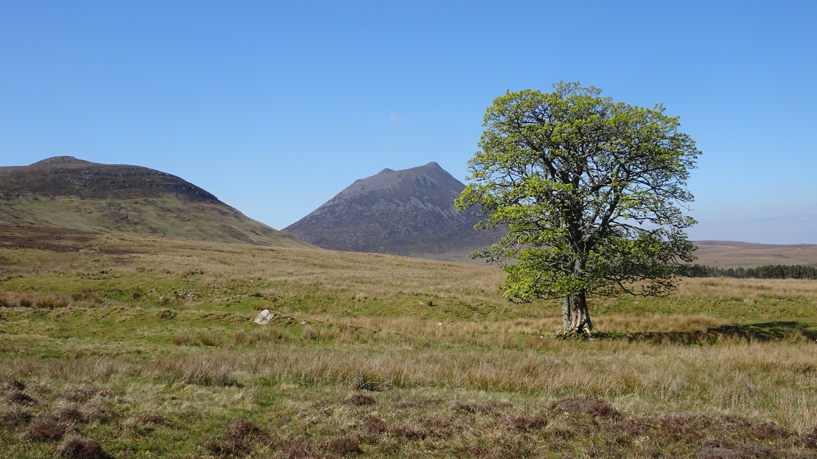
What looks from this viewing a solitary sycamore is in fact three all lining up from here.
 |
The Maiden Pap dominates from behind.

Gradually working our way around to the gap between Carn Mor and Morven.
|

The summit area of Morven with in the distance the rounded group of hills including Scaraben.
From the gap there was a fairly thuggish ascent on steep mixed heather and several boulder areas to overcome on the way to the lower summit. I would say that the final 350 metres of the uphill to be as tiring as many of the higher Munro mountains.
On the way up I did not locate a path however on the return to the gap a small cairn caught my eye and that led me to a reasonable path down to the gap.

Heading back to reach the track and to return to Braemore.

An ancient burial area perhaps....close to the track end.

The wee disused building.

The weary walk out after a fine day in the hills...a disused building at the end of the track.
Such a beautiful wilderness! I got inspiration to go there as well.
ReplyDelete