
A visit to Scoresby land in NE Greenland in 1968.

A visit made with others to this area on the edge of the Arctic Circle when in my twenties.
We travelled by scheduled flight from Glasgow to Keflavic in Iceland and then by bus into Reykjavik and later on a flight in an old Dakota to the Danish base at Mestersvig.

Our first camp a short distance from the base.
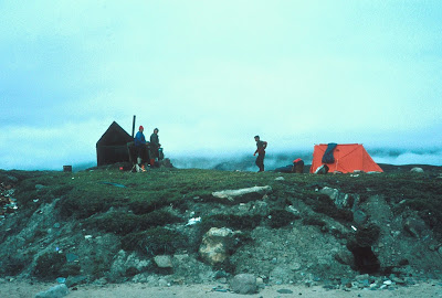
The wee hut or Fangsyte is used by folks as a hunting stop-over.

The folks from Munich to whom we lent the orange tent after some of their kit was lost.
I think that the water is King Oscar fjord.


Who needs a tent in settled weather the wood, washed up along the fjord side, probably originated from the great Soviet Union rivers that empty into the Arctic sea.
There don't appear to be trees in Greenland.

GT kitted up to head up to the glacier

Resting during the walk in ….one member plus the most of the kit went in by rubber boat with a small outboard motor.

Our base close to the outflow from Gully Glacier.

The Welsh folks in the area had a problem with the engine so a tow was applied.

Our first camp on the glacier.


Always a possibility during glacier travel.

A bit of medial moraine showing in the image.

Tough walking on the glacier.


The wider crevasses allowed a descent and re-ascent. 
Tortuous travel in this area.

Our highest camp on the glacier.

Tony and I made an attempt on a ridge on Norsketinde we made  a bit of progress but after we decided that we did not have the skills to push on further we roped down.


Brian roping-up for the ascent of the couloir up onto Norsketinde.


Brian and Willie descending from the Norsketinde.
Brian and Willie.

The outflow from the glacier into the fjord with the main Medial moraine prominent.


A sort out after descending from the Glacier.


Comments

Popular posts from this blog

Using the Burma Road to reach the Dulnain and beyond.

 The rough Estate track is approachable from the A9 road close to Aviemore and is used, in addition to the now Forestry work that is at present ongoing, and by walkers and off road cyclists. The way upwards gives very fine views outwards to the Cairngorm hills and from the high point on the track access to one of the Corbett hills and the way outwards and down into the quiet Glen through which flows the Dulnain river a tributary of the river Spey. Through the gate then ramping upwards. The Cairngorms appearing much grander with the additional cloud. The high point on the trail. Reaching the Glen and with the restored cottage at Caggan below. Below can just be seen the bridge to cross the Dulnain River. From the bridge crossing looking upstream to an estate Bothy and into an area when Curlews, Oystercatchers and Lapwings arrive for the Summer.  The upstream Bothy. To a past Guardian of the Glen. The fine looking Croft at Insharn through which the N7 cycle route passes. The track divides

Glen Tromie, the Gravel Track, the Corbett, and Glen Feshie.

 We began this day out from the Wildlife Park with just a short distance into Kingussie the only part of the journey that was on a road with traffic.  I don't think that bikes and traffic mix well on a busy road. However we survived the ride during the few kilometres into the village.  We were happy to reach the Speyside Way trail and follow this off-road to reach Tromie Bridge and then follow the Glen track until we left it to gain the Gravel Trail. Some old farm buildings that have become Holiday accommodation. A fine wee cottage above Lynaberack Lodge. Bhran Cottage. A look down on the way to the upper part of the Tromie. Now on the gravel making use of the surface to reach the higher ground. The surface has been established for vehicles to reach the area when the planting of millions of trees happens. I guess that fences will come soon? However the track is very well made with loads of drainage systems and the edges have been re-established with the vegetation. A very different

A Herding Dog visits a small area of the Cuillin.

 Over two days Spot walked over a few of the smaller hills in the area. The first day was on Hills above Loch Slapin Sgurr nan Each, the Corbett Garbh-bheinn and the Graham Belig. On the second day after leaving the vehicle at Elgol the water taxi was taken into Scavaig and Loch Coruisk was walked around and then the coastal path was followed past the wee, so called, bad step to get to Camasunary Bay and then continuing coastal path walked back to Elgol. A cool down after a day out. Where the water taxi leaves from to reach the Cuillin. Happy to be at Coruisk....lots of fresh water to swim in. Camasunary Bay with the South flank of Blabheinn behind. The path down to Elgol...Rum in the distance.