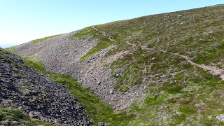
Some of the hills above Glen Feshie.

A Few of the Sgorans range of hills above Glen Feshie.


First hillwalking trip after the halt on account of the Virus. An area of the Cairngorms on the Western fringe of the National Park well the part of the Park that contains what we know of as the Cairngorm hills. I left my motor at the Allt Ruadh parking area just managing to Squeeze in beside another twelve vehicles.
Using the good path up from the area I left the path just before the ford crossing of the Allt Coire na Cloiche and headed up to the high point on pleasant vegetation. Although there was the possibility of coming across at least 25 or so folks on the hills in fact in such a large expanse of terrain during the day humanity became just specs on the distant paths with only occasional meetings with folks on the same itinerary as me but doing the walking in the reverse direction.

                                                             The Sgorans.

 The summit area of  Geal-charn, one of the several de-frocked former Munros, with a bit of Loch Insh and the Monadhliath Hills in the distance.
A few slots/channels with paths between the hills. 
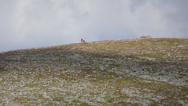
Two folks approaching Geal Charn ....me looking back from my traverse.
The summit cairn of Meall Buidhe
Path probably made by deer travelling into the coire.
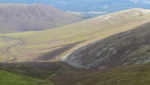
Now on the path from Sgoran Dubh Mor to Sgor Gaoith skirting the vast Eanaich trough looking out towards the Coire Dhondail path, with access to the area of Braeriach and Carn Toul, left of the twin water slides.
Loch Eanaich from the summit area of Sgor Gaoith..
Approaching Sgor Gaoith with a walker from one of the many alternative ways of reaching the summit.
I chose a direct descent into the shallow coire of Gorm a'Chrom Alltain in order to reach the path that nowadays seems to be the way that most folks use to reach Gaoith?
Not the best of zooms but there are two paths out from outflow from this coire....the one that I used can be seen heading across the flanks of  Meall Tionail a path that just ends but below this point the lower path, the one out to the allt Ruadh can be easily reached.
The Lower path in from the Allt Ruadh has now over the years, since the de-frocking of the Munros took place, has now ploughed a way up to the area between Carn Ban Mor and Sgor Gaoith over laying a very feint old possibly stalkers track.
My version of the 1;25,000 O.S. Map does not show the all of the paths and extensions to paths.
When descending in the coire a little clump of white Calluna.  There were several patches of  Cloudberry that were past there best.
Off road bikers on the lower track when I was descending to get onto the allt Ruadh path.
Quite glad to get onto this path and just kind-of just shuffle out along the path to the parking area....the long period of not being out on the hills was taking its toll on my legs and this despite being out on my off-road bike frequently during the past few months.


On the way up to Creag Ghiuthsachan

Cairn at .737 below Lochan nam Bo.


Comments

Popular posts from this blog

The GR20 a walk through the mountains of Corsica.

Several of our trips to Corse began with a flight into Nice airport. Before reaching the port for a ferry to Bastia or on one occasion to Calvi we trended towards the wee hill with the outlook over the city. On other occasions a flight into Bastia Poretta was the choice of to reach the island.  The trail takes the walker from Calenzana down to Conca following ancient paths and mule tracks used in the past to move animals to the higher areas in the summer season.  This practice of transhumance carried out on many parts of the route is still practiced today.  It is not unusual to find goats, pigs, sheep and cattle along the trail especially near to the several bergeries (small high level stock farms) encountered during the walk. The trail was initiated by Michel Fabrickant a civil servant and mountaineer who worked on the Island and who took onboard  the itineraires Corse of Jean Loiseau and the idea of Guy Degas of a route from Calvi to Port...

Glen Tromie, the Gravel Track, the Corbett, and Glen Feshie.

 We began this day out from the Wildlife Park with just a short distance into Kingussie the only part of the journey that was on a road with traffic.  I don't think that bikes and traffic mix well on a busy road. However we survived the ride during the few kilometres into the village.  We were happy to reach the Speyside Way trail and follow this off-road to reach Tromie Bridge and then follow the Glen track until we left it to gain the Gravel Trail. Some old farm buildings that have become Holiday accommodation. A fine wee cottage above Lynaberack Lodge. Bhran Cottage. A look down on the way to the upper part of the Tromie. Now on the gravel making use of the surface to reach the higher ground. The surface has been established for vehicles to reach the area when the planting of millions of trees happens. I guess that fences will come soon? However the track is very well made with loads of drainage systems and the edges have been re-established with the vegetation. A very...

A walk through the Vanoise ..Landry to Modane on the GR55..

We arrived on an afternoon train to Landry in wet weather. All a bit gloomy when we sought out a place to pitch our tent and where the soggy ground conditions told us that a fair amount of rain had fallen recently. We were about to follow the GR55 route that can be followed through to Modane and where there would be trains coming through the tunnel from Italy.....ideal for us to get back to Geneva for our return on the Easy Jet service to Edinburgh.  The GR55 can be used as a more direct route as part of the GR5 trail that links Lac Leman to the Mediterranean. The following morning with rain still falling we  decided to head up to a camping site Le Lanchettes, close to the Refuge at Rosuel, and wait for a change in the conditions. After a couple of days the clouds parted and revealed the white covering of the terrain to where we would be walking.                                  ...