Following a stage of the Dava Way with a diversion onto the higher moorland...and with a continuation through to Forres.
The Dava Way follows an abandoned railway track from Grantown on Spey down to Forres. Having parked up near to the bridge over the river Spey we cycled into Grantown and passed by the Camping Site to reach an under bridge to then engage with the route. The trains that operated on the track here were in operation until the savage cuts to rail services in the mid sixties. As far as I know the service from here to Forres was the only available way at that time in the eighteen hundreds to get to both Inverness or to Aberdeen? The later service beyond Aviemore to get to Inverness directly must have affected what happened to passenger numbers on this service.

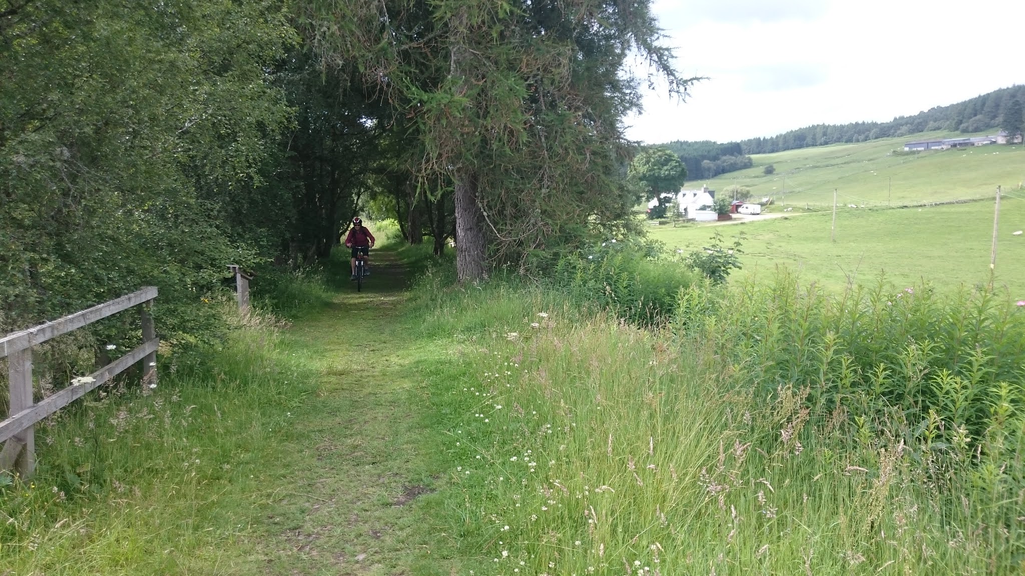
Typical travel on the old track now overgrown and producing a tunnel to cycle through.

Looking down on the gatehouse to the old Grant Estate from the Dava Way, on a bridge, that crosses the road into Grantown on Spey.

Marif beside the gate used by the Estate Laird to gain access to the train service. The gatehouse to the Estate is a two story building with a door from an upstairs room to reach a fine wee garden and then through the gate....a rather special waiting room.

We left the Way near to Lynmore to pedal our bikes at first down then steeply up on a very fine minor road to reach the Moor at round 300 metres. We would experience the rest of the Dava way stage on return from the area of the old Dava station.
The wild thyme announced summer in Scotland.

Marif reaching our high point on the moor with the Cairngorm hills in the distance.
Reached by passing Carn a' Ghille Chearr...the hill of the unlucky boy with also one of these in the Cromdale hills.... and yet another Huntley's Cave and passing over the Cairngorms National Park boundary at .383.

Signs of past lives lived up on the moor.

Perhaps the home of a shepherd looking after sheep flocks in the old days although there are still sheep on the moor but maybe looked after by folks living at a distance from the moor.

The site of the old station at Dava where we re-joined the Way for our cycle back to Grantown.

A very slight gradient up to the high point on the old track.
Much appreciated after the high point all the way back down to Grantown.
It was around this area that the train service was fairly frequently halted in winter, even up to the early sixties, when snow filled the cutting to close the track.

My first thoughts were what the heck is this guy doing here.
But maybe he should be facing the current road ...a few hundred metres away rather than facing the old rail-track. In the past the current road was the Military road made for getting troops around the highlands.
Note the falling apart fence that was in place to stop the snow drift from forming.
In all a very pleasant day out but after leaving the fine tarred minor road up to the start of the moor, Lynmore up to Auchnagallin, we did not see another walker or cyclist until we got back close to the camping site in Grantown on Spey.
A return to the Dava Way this time to continue down to Forres starting from where we left off a week or so earlier.

To begin our way Northwards from here we have to, having found a place to park, to travel a wee bit on the A940 to get around a part of the Way accessible only for walkers....apparently Cyclists are not welcomed on the section of the old rail-track where there is a dwelling house.
The area where there is an old very large shed used now by the 'roads maintenance folks' and has large No Parking signs where poor parking has has caused problems of access and on top of that the folks living nearby in a roadside house have had to put up with litter and abuse from the 'car picknickers' stopping at this location and as we found out it is quite a sensitive area where folks reaching the Dava Way come into contact with those living here. Having met a gentleman, living nearby, before setting out I fully understand all of this and I did by best to avoid any upset here.

Looking back to the track that walkers would follow and on the right the track that gave we bikers access.

Nice to out on the moor again with the pleasure of breathing in the fragrant moorland vegetation.

The fine little shed I guess from the Railway days that has been looked after and fitted out by the Volunteers who look after the trail and give up their own time to keep the route in good order.

The hut book where the folks visiting the route in mid July this year have left notice of their thoughts about the route.
It would appear that this wee building...the halfway hut... is halfway between Grantown on Spey and Forres.

The Divie Viaduct.

A pleasant view from the Viaduct.

The route is on a bypass of the old platform here at Dunphail...maybe the old station building is used as a home now?

Another change of direction up onto the overbridge, for me, an off the saddle pump, to get onto the bridge via a short ramp.

Another diversion from the old track to bypass a dwelling house that leads leftwards onto a section of a path through the forest until this opens out onto a flatter area towards the Dallas Dhu Distillery Museum. The buildings are in very good shape and with a well laid out parking area for many vehicles but alas all was closed. Maybe having under gone a makeover it will open up soon?
I was looking forwards to a coffee and for something to eat.
Of course being an abandoned railway track a great deal of the route across the moor is a straight path but at both ends there is some interesting terrain where the route is diverted away from the old permanent way. On the warm summer day that we had it was a real pleasure to be moving between the two towns.
Easily now into the outskirts of Forres and very soon you are into an area of immaculate lawns with very smart homes although difficult for me to find the connection on a small track between the homes to get into more of Forres. There follows a park with a pond with a grand wee waterfall...past a couple of Schools then a roundabout... and a one way narrow street that opens out onto the main street with cafes and all the rest.
An enjoyable day out and so now to get back to where we left the vehicle.
Comments
Post a Comment