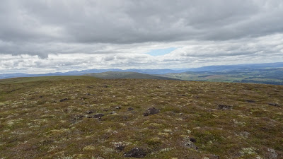
Our Sunday walk this week was to the Cromdale Hills.
Our approach was from the alternative road section used on the Speyside way.
The crossed sword symbol used to indicate a place of battle on Ordnance Survey maps was something to look at and along with the 1690 date it conjured up the strife that took place in Ireland when the Jacobite army of James V11/11 was defeated by the incoming Protestant Monarch William.
Of course the Highland Scots Jacobites along with others were opposed to the change and a group of them were defeated by the Government army in this area and it would appear that after the fighting at Lethandry Castle that there was further action closer to the hills and, it has been said, that a Piper gave encouragement to the action at the Clach a'Piobhair boulder.
Area of the fighting with broken down houses.
Cairn at the site.
An easy approach track.
The pipers boulder.
The pipers boulder when I passed this way on descent from the hills Twelve years ago.
We pushed on from here in an increasing wind and had to bailout at 650 metres and to get our backs to the wind before descending. We are both in our early eighties and find that in a wind we are less stable.
Just located amongst my images taken in 2010.
Coronation cairn for Edward V11...and a couple more following.
Approaching the jubilee cairn.
In the summit area of Creagan a' Chaise at 722 mtrs. also has a trig point, and to what we were walking towards there is the Jubilee Cairn erected for Queen Victoria.
Our escape route was to get to the low point of the Traverse between the two hills with the wind behind us and to descent from there.
Carn a'Ghille Chearr seven kilometres away from the hill at the South end of the Cromdales with the fine Ben Rinnes in the distance.
Carn a Ghille Chearr can be approached from the Strath Avon side by using the bridge crossing near Ballcorach on the B9136 where there is parking after the bridge crossing. We followed a track close to the river and then up a concrete farm track up to Knock where we engaged with the Right of Way track that can be walked up and over to the Cromdale side of the hills.
The remains of the old farm building at Knock and with an falling apart old overshot mill wheel.
Beyond the old farm there is an ancient protected Earth House that doesn't allow for folks to crawl around the site. There are images of the site to be found on line.
A fine wee pond just above Knock seen from the path over the hills.
The R of W path upwards to the high ground.
From the path a look down to the Tomintoul Distillery
A wee lichan growing beside the path and as is usual the bell heather is flowering well ahead of the dominating in this area common heather....Calluna vulgaris.
The distant Ben Rinnes.
The summit trig point of Carn a Ghille Chearr with Marif getting herself cosy at the concrete pillar.
Close to the summit we met up with a couple, from South of the border, with their dogs who had, from the farm of Milton, on the road on the hill side of the Strath had used the track from there to reach Creagan a' Chaise at the far end of the high ground seven Kls.away and then walk out to reach our summit in the North end. Probably using the Path we used for ascent to get down and follow the narrow road back to their vehicle.
A bit of a path heading back to Carn Eachie with the higher Cairngorms in the distance.
Up here paths come and go.

.jpg)

.jpg)


.jpg)
.jpg)


.jpg)


Comments
Post a Comment