The hills are out of bounds and using the motor to reach them is also not encouraged.
Since I live within the boundaries of the Park I could reach some of the trails and sections of the 'Walking Ways' within the Park by using my cycle on round trips from start to finish.
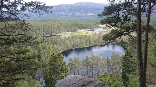
A few images of the section of what will become the new stage extension of the Speyside Way....Kingussie through to Kincraig or in the more likely way for walkers Kincraig to Kingussie....I think that most walkers start from the North....well that is the way that it is written up in the book of the multi day walk.
 The RSPB hide close to the Ruthven barracks.


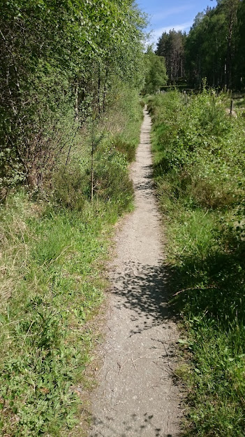
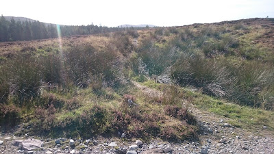
 The trail becomes a bit more difficult on the cycle.


 One of the several variants from the organised Way is to reach the Trig Point at Creag Dubh and to experience the two trails that descend from there.


 The right side route from the Trig point come out at the track a couple of hundred metres from the ruins at Corarnstilbeag.


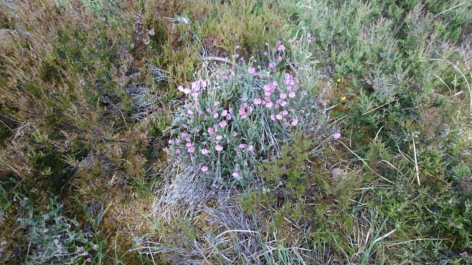
Common heather, Calluna Vulgaris, in the clear felled area.


 After passing through a gate uphill after the junction.
 The bridge over the Allt Chomhraig.

 A short path section left before the sweeping bends.
 A look back to the bridge from where the path joins the vehicle track from the river.
 The ford over the Allt Mor.

 The Bridge in September 2010 in position above the confluence of the two streams.
 The track out to where it climbs out to descend into Glen Feshie.
 From the trail the remains of a sheep-fank can be seen.
 The start of the path that can followed over higher ground into Feshie across the flanks of Creag na Sroine and descending to the estate buildings.
 Where the trail up from Feshie and across the flank of Creag na Sroine comes out of the trees...an old gate but now without any fence. Must say that I have only ever ridden this section from the Feshie turn-off down to Corarnstilmore
 A short time later where the trail cuts through the heather on a established path and then into a fire break in the plantation before ending on a path to join the trail close to the Corarnstilmore Fank.
Since I live within the boundaries of the Park I could reach some of the trails and sections of the 'Walking Ways' within the Park by using my cycle on round trips from start to finish.
Using the B road into Kingussie I can gain access to the old Badenoch way and soon to become an additional section on the Speyside Way. There is now a smooth path beside the tarred road starting from close to the barracks, firstly on the right and later it switches to the left, prior to reaching the Hide.

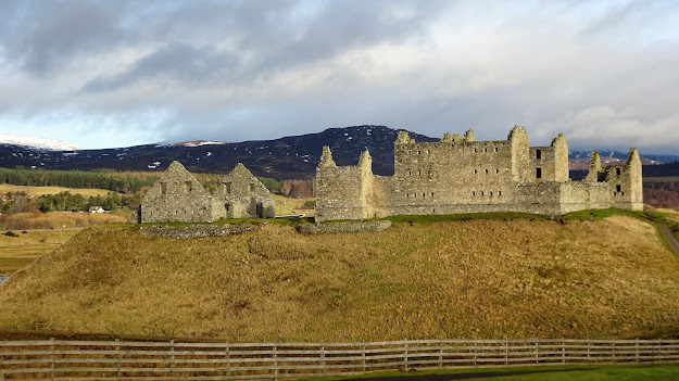
What is left of the old Ruthven barracks.
On each of the three days out described it is possible to do Variants depending how you feel on the day
A few images of the section of what will become the new stage extension of the Speyside Way....Kingussie through to Kincraig or in the more likely way for walkers Kincraig to Kingussie....I think that most walkers start from the North....well that is the way that it is written up in the book of the multi day walk.


Using the newly constructed path starting from close to the old Ruthven barracks the Bird Hide can be visited and then on the same trail onwards the bridge crossing over the Tromie river and on the to the trail up to Drumguish.
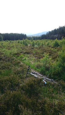
These two cycles were locked up one of which had some flower power and also some battery power available.

There is an alternative way to reach Tromie bridge using the old Badenoch way section.
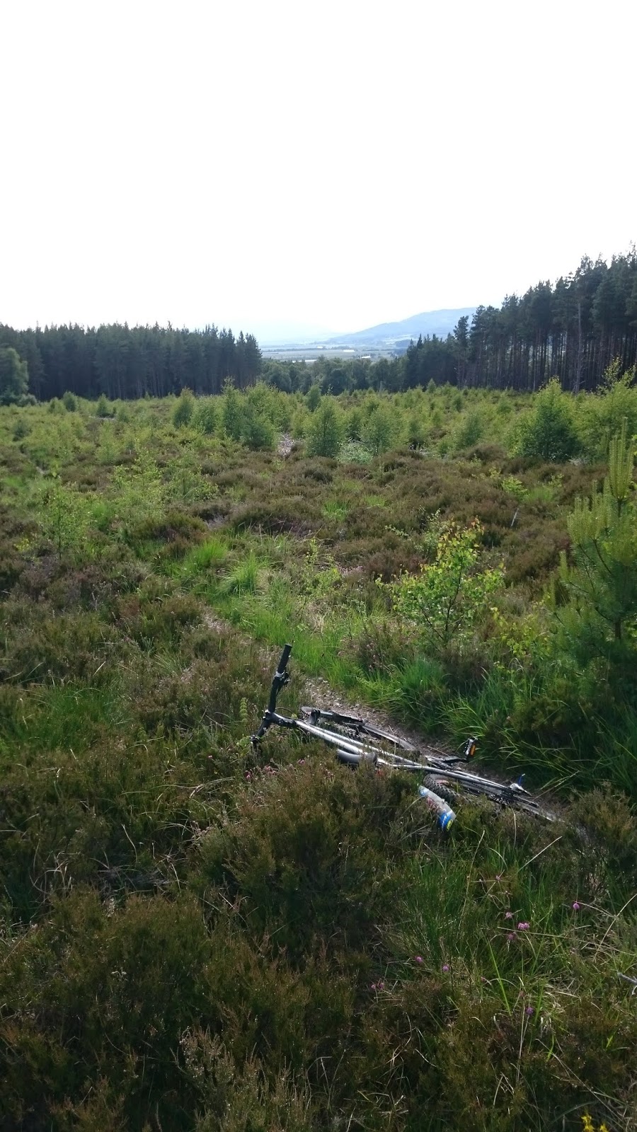
The image shows when looking back on what is the easiest part of this section...there follows some quite tough parts when using the cycle....be prepared for a few tumbles or as will do next time use the new prepared track on the Speyside Way from The area of the Barracks through to Tromie Bridge.


The viewpoint bench.

Same bench with more of the Sgorans showing taken ten years earlier with the old HP camera.

A viewpoint with a bench to rest at with in the distance the Feshie Cairngorms.
Sgoran dubh Mor and Sgor Gaoith showing.

Close to Tromie bridge...once the gate is negotiated an easy path to reach Tromie bridge.
The Drumguish cross roads

The wee hamlet of Drumguish.

A look back to the gate leaving Drumguish.

Surface changes, I am happy with the old worn paths, but I guess it will all have the same surface eventually.

Approaching Inveruglass ….Geal Charn, Sgoran Dubh Mor and Sgor Gaoith in the distance.

Same track before the upgrade. Ten years ago when I came this way at that time heading towards Drumguish.

Looking out across the Spey and the A9 to the lands acquired by James Ossian Macpherson in the distant past.

A fine old path section in the area of Inveruglass/Insh.
Kind-of overlooks the rear gardens of the homes.

The path leads down almost to the B970 where is a Badenoch Way trail Post, almost hidden in the vegetation, between the entrances to two properties. Turning right here takes the walker on a wide track, back into the forestry plantations.
NH 8192 0190

After passing the hamlets of Inveruglass and Insh on a mixture of old and newly made paths the old path used on the Badenoch Way that takes the traveller up to the area of Creag Far-leitire.
NH 82220167

Same old Badenoch Way path that gives a pleasant gentle uphill ride to the Far Leitire area.
Again can be used as an alternative path to the forest road that now is marked as the route.

Doing the trail the opposite way around.
Go right to avoid the link to the forest track and at the wee cairn take the fine path down to reach the forest track which when followed will get you on to the path firstly to the Insh hamlet.
A clear felled area now growing trees again.


Shortly after the trig point there is a trail split ...the left one takes you, after a rumble descent, out to a forest track that in descent will bring you out to the area of the Uath Lochans.
The right track brings you out, after a rumble descent, to the track close to Corarnstilbeag.


All that is left of the old sheep-farm at Corarnstilbeag.


Bog Asphodel in the cleared felled area.
All within one stride from the old Badenoch Way path.
The first of the native heathers, looking a bit limp in the very dry conditions, cross-leaved heath Erica tetralix…..the heather that prefers the wetter ground.

Bell heather ...Erica cinerea

Probably the high point of Creag far-leitire.

The fine view out from Creag Far leitire out over the Uath Lochans.

Image with more of the Cairngorm Sgorans above Glen Feshie ....taken a week after the earlier one.

Also a popular family place to visit on a Sunday from the Parking/Picnic area at the Uath Lochan.

A newly built section of the Speyside Way that takes the traveller down to the hamlet of Ardgeal.

Well sign posted at the Kincraig end with new freshly painted Speyside Way arrows and distances.

From the path desending to Kincraig looking down on the Watersports Centre and Loch Insh.
An Alternative wee route out to Glen Feshie from Drumguish.


Cross roads in Drumguish.


Fifty metres above the ford there is a bridge. Both Bridges in this area were constructed by Glasgow University students. I also think that this bridge has been moved from the original site downstream near where the confluence is to found.


Over the years I have known this trail up from Glen Feshie to be the Kennels trail.


The Garbhlach burn crossing.
 The area where the path has been washed away....now there is an alternative way to reach the upper Glen...Looking back on this area when coming from the North.
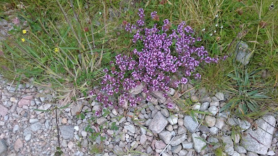
Thyme beside the trail.
 To avoid the washed out area a left turn at this path junction. Now signposted.


 From above the Bothy the start of the upper Glen.....Glen Feshie takes a turn, hidden in this image, to the left to reach the high point and to where the Eidart river joins. Slochd Mor is to the right with an estate track snaking up and Slochd Beag is in the centre of the image.
 Recent winds have damaged an old Aspen tree close to the Bothy.
 A little way above the Bothy the old track now finishes at the river....erosion changes? Anyway to get further up the Glen take the fresh path at this junction to regain the old track.


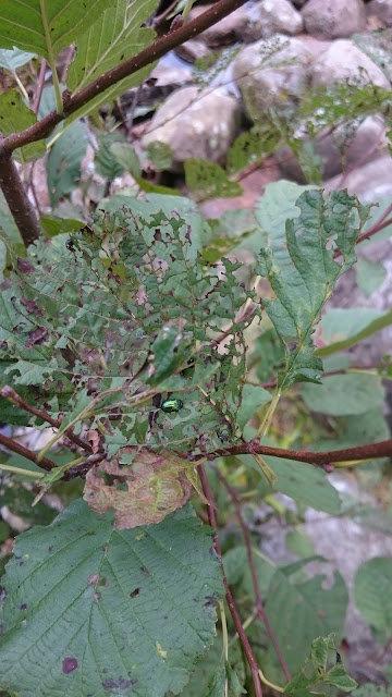 Passing this way in early autumn where the wee Alder tree beside the bridge support has been overwhelmed by the Alder Leaf Beetle.
 Must say that I enjoy speaking to folks when I am out....on this occasion when crossing the bridge with my bike I became aware of two ladies out for a walk who had spotted the the Beetles and the munching of the leaves that was happening. I got some information from them and was alerted to the Beetles.
Images of a trip into Glen Feshie of the area approaching Ruigh Aiteachain Bothy.

I used the cycle track beside the dualled A9 to reach Kincraig and into the forest paths to get me up into Glen Feshie.

Lower down in Glen Feshie some fine spring blossom.

There are several ways to access into Glen Feshie and the river takes its toll on the paths.

The junction with the fine old path that leads to a crossing of the Garbhlach burn.
 |


Thyme beside the trail.


Glen Feshie Lodge.

The Bothy.

Ruigh Aiteachain Bothy.


From my home a journey to Glenmore by way of the Moor of Feshie, Loch an Eilein, Rothiemurchus and Loch Morlich and return.

Into the Moor of Feshie forestry plantations above Feshiebridge.

Right turn at the Cairn to reach the Bothy.

Jack Drakes Bothy.


When using the Moor of Feshie approach to Loch an Eilein there is a rough wee track to negotiate.

Loch Gamhna from the rough wee path.
 |
| The Path seen looking back from the Loch an Eilein end. |

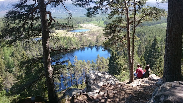
Loch an Eilein with island showing in the distance.

Lochan Mor ...reachable with a small deviation from the main trail

Many signs to keep you on track.

The Lairig, Carn Eilrig and Braeriach seen from the path out to the bridge.

Memorial close to the bridge.

The Cairngorm Club footbridge...crosses the water coming from the Lairig Ghru and from Loch Einich.


Maybe a good thing if we all slowed down a bit and looked around.😄


 The old path above the Spey prior to reaching Kincraig....the alternative is on the new track made for the organised Ways.


Piccadilly junction...looking towards the entrance path to the Lairig Ghru.

The chalet with a tree for close company in Glenmore close to the camping site.

Signs on the Loggers trail a trail that takes you quickly down to Aviemore....or up to Glenmore.

A pair of Ospreys having some excerise.

The shallow Bogach filled with water lillies.

The new bridge after which a very steep section follows....no problem for walkers.

The bete noire from the area of the by pass.

The by pass.

The bete noire from above....easy enough in descent with control.

An excess of gates on the Speyside Way? these two are five metres apart.


 |
The old path above the river Spey close to Kincraig.
Another alternative way home by leaving the Speyside Way at Dalraddy Holiday Park and using the link through Dalraddy farm and via an underpass to reach the cycle track beside the Dualled A9....on this day sheep were being dosed. Still inside the National Park during a round trip from Inverdruie. A combination of Speyside Way tracks, the big Pines trail and old trails passing the Osprey centre, Tulloch, .261 then out to area of Forest Lodge, the climb up to Rynettin, Glenmore and using the Loggers way to return to Inverdruie.  The gate, a little before Forest Lodge, that gives access to the trail up to Rynettin.  The trail splits left for Nethy Bridge and straight on for the osprey centre on the tall Pines path.  Loch Garten at the Osprey Centre.  The gate that gives access to the path up to Rynettin.  The highpoint of this trail at 400metres.  A little way off the trail towards Ryvoan Bothy there is this memorial stone...on a knoll maybe 200 metres uphill. Erected long before the Trees were planted.  |
Comments
Post a Comment