The Trail is an orbital walk around the Village and is roughly in two parts with that with the southern outlook being easy walking between the rail-track and the river Spey with the golf-course and sheep grazed fields in between. The northern part of the trail is more like an approach to the the hill areas in Scotland. Connection to the two parts is by a railway crossing, a over rail bridge and a couple of road crossings and with during the journey on the southern section there are both a rail bridge and a road bridge to walk under. At this time of the year, it is beginning to feel like early Spring, with Herons checking out their nesting spots near to the Wildlife Park and on the northern section incoming Oystercatchers, Lapwings and possibly an outgoing Woodcock that I saw above Glen Banchor
For our walk we began from the railway station when I went in an anti clockwise direction and for a second rotation I started from the River Calder bridge and did the rotation clockwise and also to have a look at the section descending the Allt Laraidh a section that has been closed for some time on account of fallen trees that have taken away some of the path that traverses the slope above the Stream.
A look back to the Station area with the high Monadhliaths to the rear.
Having crossed the railtrack and the road into the village we head up the minor road that is a substitute way for the blocked original route.
Fine wee cairn with cat symbol at the limit of the trees.
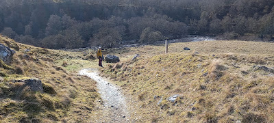
Our stop for lunch spot.
After this part of the trail the track deteriorated into a mush of mud and animal droppings most of the way down to the Glen Banchor road. There had to be a better way than this. Probably much improved in summer conditions.
After a walk up the road for a bit we connected with the track down following the Calder river.
A fine track all the way down to the Laggan road where we would connect with the Southern sector again.
.Return to the station
.
My return a couple of days later was to the Calder bridge to engage with the route but this time in a clockwise direction.

Glen Banchor.

The raging river Calder.

Spring is coming.
To avoid the deep mud on the track where it leaves Glen Banchor, a few metres above where it joins, I decided to use the edge of the plantation to bypass the deep muddy section. The plantation has now a new deer fence erected possibly to stop the deer coming together with the feeding area for the farmers cattle?
Anyway it does have a pad-locked hill-gate? however there is just showing in the image of a vehicle gate that allows access....well all I wanted to do was to reach the area where we had our
lunch two days prior....I joined the trail at the large boulder close to a sheep fank.

From the viewpoint looking out over Newtonmore....must go back here on a clearer day.
The area of the ancient Hut Circle.
Down from the higher track to make contact with the Bridge across the Allt Laraidh and the path towards the blocked and closed trail.
Many toppled hardwood trees across the path and on a steepish bank above the path.
There are several additional trees blocking the track....what I have shown is just a selection.
I must say that I think that it is right to keep the path closed since the clearing needed would be without the means of getting equipment in here....I guess that it is not just about a chainsaw cutting through the tree trunks.
But I guess it is a great loss for the walkers wanting to use the path.
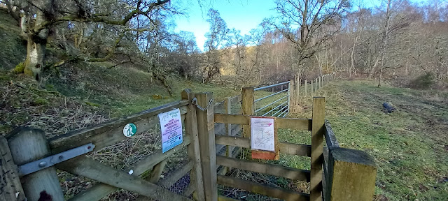
The notice at the start/finish of the path telling of the closure.
The coniferous trees in the area have taken a big hit from the winds recently.
From here I made my way back across the road and using the Cycle path to reach the continuation of the trail back to the Calder bridge...over a railway bridge, twixt grass fields, golf course and under bridges carry both trains and traffic. A grand day out walking and having lived in Badenoch for forty .
.years. I am glad that I got around to walking.
Under the railway bridge, through the arch of the road bridge and over the Laggan road bridge to finish.


Comments
Post a Comment